AI paves the way for better road maintenance
Maya Westcott
Jul 17, 2025
Dodging potholes is a familiar routine for drivers. But, behind every bump and crack in the pavement is a bigger issue: many communities lack the tools and data they need to maintain their roads effectively. Traditional pavement assessments rely on expensive, specialized vehicles outfitted with high-resolution sensors. These resources are typically reserved for major highways and high-traffic corridors, leaving neighborhood streets and local roads under-monitored and under-maintained.
Researchers at Carnegie Mellon University developed a low-cost, AI-powered solution designed to close this gap. Using a smartphone app created by computer vision company RoadBotics, alongside open-source data such as weather patterns, traffic levels, built environment characteristics, and socioeconomic information, the team was able to predict pavement deterioration across entire road networks. When installed in a standard vehicle, the app collects road imagery, which AI models then analyze to assess current pavement conditions and forecast how they will change over time.
“The method offers comprehensive coverage, enabling analysis of all road segments throughout the entire network and across multiple time scales,” said Tao Tao, postdoctoral researcher in the Department of Civil and Environmental Engineering and lead author of the study published in the Journal of Infrastructure Systems.
Tested in nine diverse communities across the U.S., the model demonstrated strong performance in predicting pavement condition ratings and their rate of decline. Unlike traditional methods, this approach also takes into account how factors like road classification, climate, and neighborhood demographics interact to influence road wear. These insights have the potential to give city planners and public works departments a more complete understanding of where and why deterioration is happening.
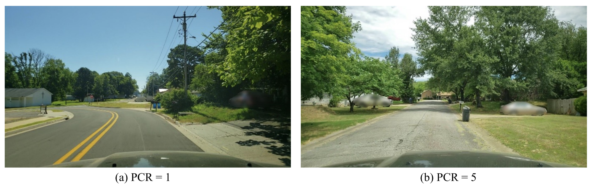
Source: RoadBotics
Two example road segments with different PCRs: (a) PCR=1; and (b) PCR=5.
“By combining AI with readily available data, we're enabling communities of all sizes to proactively manage road infrastructure with greater precision and affordability,” said Sean Qian, professor of civil and environmental engineering.
In contrast to current methods, the impact would be far-reaching. In small towns and rural areas where technical capacity and budget are often limited, the tool provides a practical low-cost way to assess road conditions without the need for expensive equipment. In mid-sized cities trying to stretch infrastructure budgets, it helps identify which roads are predictively most at risk in the next few years and where preventative maintenance will have the greatest return. And in large urban areas, it supports more equitable decision-making by including residential and lower-income neighborhoods that are often left out of traditional assessments.
This approach envisions a future where every community can harness data-driven insights to proactively manage and preserve their roads
Tao Tao, Postdoctoral researcher, Department of Civil and Environmental Engineering
Qian and Tao plan to refine the model further by tailoring it to specific communities and incorporating additional data sources, such as road age and pavement materials. The goal is to create a flexible, scalable system that empowers communities to make smarter infrastructure decisions even before potholes form.
“This approach envisions a future where every community—regardless of size or resources—can harness data-driven insights to proactively manage and preserve their road infrastructure,” said Tao.
This work was funded by the Pennsylvania Infrastructure Technology Alliance and conducted in partnership with RoadBotics. The paper was recently selected as the Editor’s Choice Paper by the Journal of Infrastructure Systems and highlighted by the American Society of Civil Engineers.